
Hit the Trail
Through the years the deer who call this area home did a good job of developing trails for their use...and they continue that work today. However, the trails that we use for our operations weren't designed by deer and didn't come by accident.
We enjoy a typical Indiana river frontage terrain...complete with steep hills, wandering creeks, ponds and wetlands. In this environment trails for tractors and ATV's are a challenge to build and maintain - and we've spent years (literally) giving good thought to (and getting great advice on) where and how to construct our trails.
All this work has an interesting history to it.
When we purchased the farm in 1991, we immediately enrolled the property in the Indiana Classified Forest and Wildlands program. This provided access to DNR forest and wildlife management advice and the development of a forest management plan. And to take that management plan to the next level we later became certified in the American Tree Farm System.
All that planning helped to clarify and document our objectives and strategy. The long-term objectives include optimizing hardwood timber value and the growth of a “sugar bush” (that’s industry talk for a woods full of sugar maple trees).
And the strategy for that timber stand improvement program includes: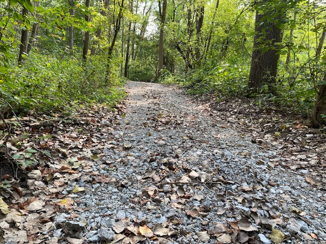
- the planting hundreds of Purdue #1 black walnut seedlings
- the planting of trees as needed for forest regeneration
- deer control
- and an ongoing initiative to control invasive plants such as multiflora rose, brush honeysuckle and tree of heaven to name a few.
To the point of this article itself, the implementation of the plan required the construction of about two miles of trails and roads to provide access to the land for the control of invasive plants…not to mention better access to the sugar bush.
Being good stewards has always been important to us. So to make sure the trail design and construction work was done correctly, we engaged the experts through the White County Indiana Soil and Water District and the U.S. Department of Agriculture National Resources Conservation Service (NRCS).
Together, working closely with us they led the design of a detailed trails plan including the exact path for the trails and the placement of erosion control features (water-bars, crushed stone surfaces, slope grading specifications, etc.) as well as an itemized budget estimate to help us and the excavation company we used to scope and manage the cost of the project. For the actual trail construction, we chose a company whith proven experience building similar trail and road systems, i.e., Wrede and Sons Excavating in Monticello, Indiana.
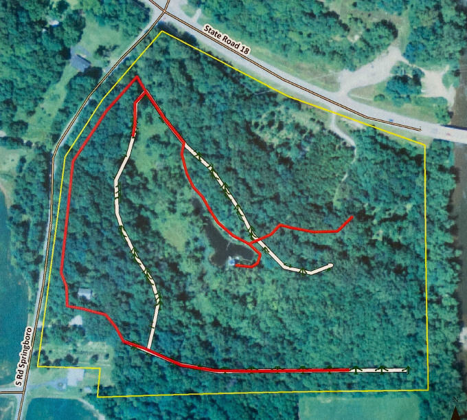
Here’s a map of the initial trail route design.
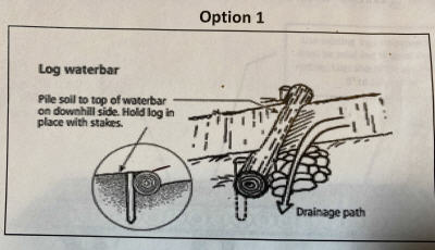
This drawing shows the construction of water-bars you’ll find throughout the segments of our trails on hill sides.
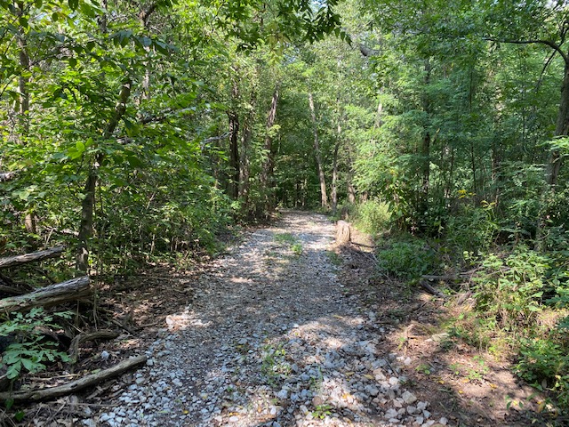
Here’s a segment paved with #2 stone. It’s the base for the trail and provided the needed support for driveway stone.
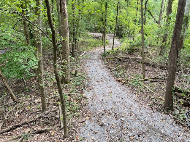
Here’s a finished segment of a trail now covered with #53 driveway stone.
Of course the best way to find out more is to come for a visit and an ATV ride someday during one of our open houses......but if you’d like to know more now, here a few helpful links:
Interested in the Indiana Classified Forest and Wildlands program? Here’s a link for more info:
https://www.lincolninst.edu/sites/default/files/gwipp/upload/sources/Indiana/2008/IN_Sourcedoc_ND_Classified%20Forest%20and%20Wildlands.pdf
Interested in the American Tree Farm System? Click here.
https://www.treefarmsystem.org/certification-american-tree-farm-system
Want to see more detail about forest road design and construction best management practices? Here’s a line to what the folks and the NRCS used as guidelines for the development of our plan.
http://www2.dnr.cornell.edu/ext/bmp/index.html
